
Scribble Maps Blog
Six New Map Grids: Map Reference, Square, H3, GARS, Maidenhead and Range Rings
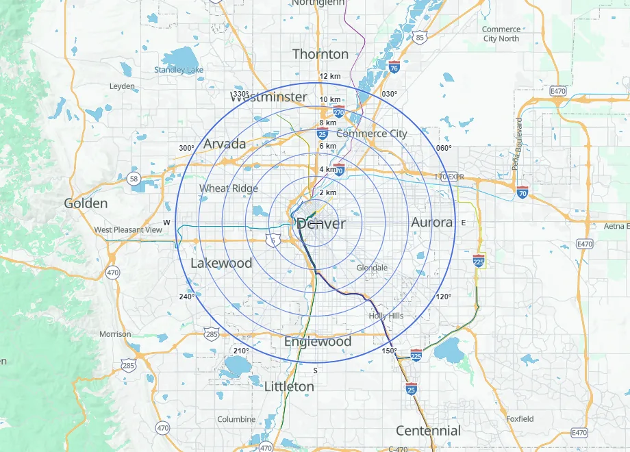
A grid turns a map into something people can talk about. "Meet at C4." "The fire is in 006AG3." "Everything inside the 5 km ring gets same-day delivery." Until now, Scribble Maps had grids for latitude and longitude, UTM, USNG, MGRS and the British National Grid. Today we are adding six more, plus a line color for every grid and rebuilt LatLon and UTM grids.
What is new
- Map Reference: lettered columns and numbered rows, like a street atlas.
- Square Grid: square cells of an exact size, from a few meters to many miles.
- H3 Hexagons: Uber's H3 cells, for data analysis and delivery zones.
- GARS: the Global Area Reference System used in defense and emergency management.
- Maidenhead: the grid locator system used by amateur radio operators.
- Range Rings: rings at set distances around a point, with bearing lines.
- Line color for every grid, and faster, clearer LatLon, UTM and BNG grids.
A grid is saved with your map, so everyone who opens the map sees the same grid. It also follows the map smoothly as you zoom, instead of jumping into place when the zoom ends.
Map Reference: "meet at C4"
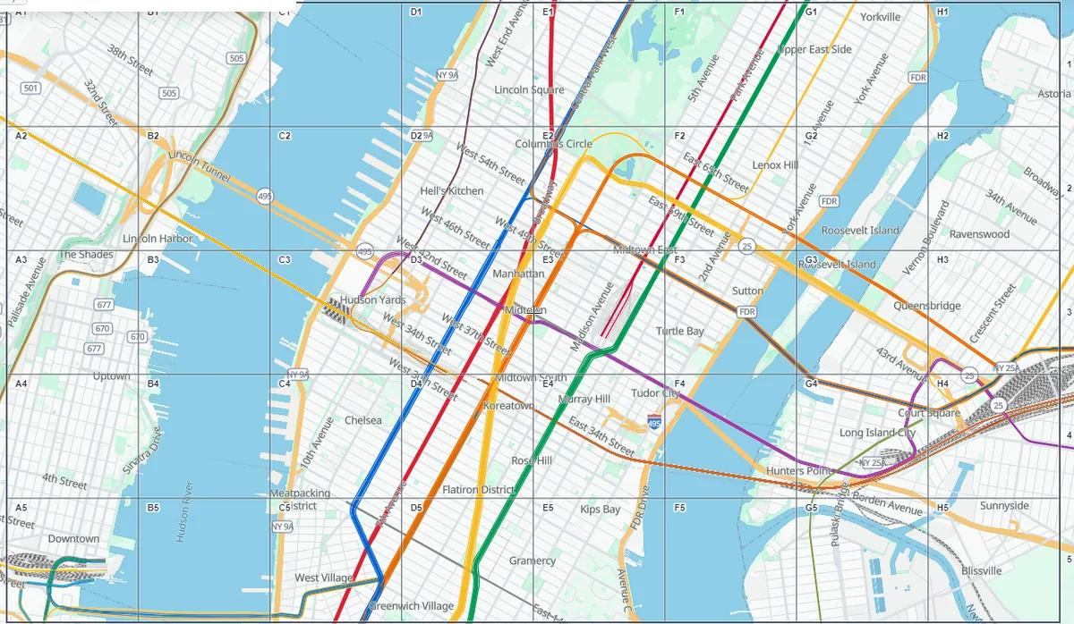
Map Reference draws lettered columns and numbered rows over the area you are looking at. It is made for printed maps, event maps and shared maps, where people need a simple way to point at a spot. Choose up to 52 columns and 99 rows. When the cells are big enough, each one shows its name, such as B4. Fit to view moves the grid to whatever you are looking at now.
Square Grid: cells of an exact size
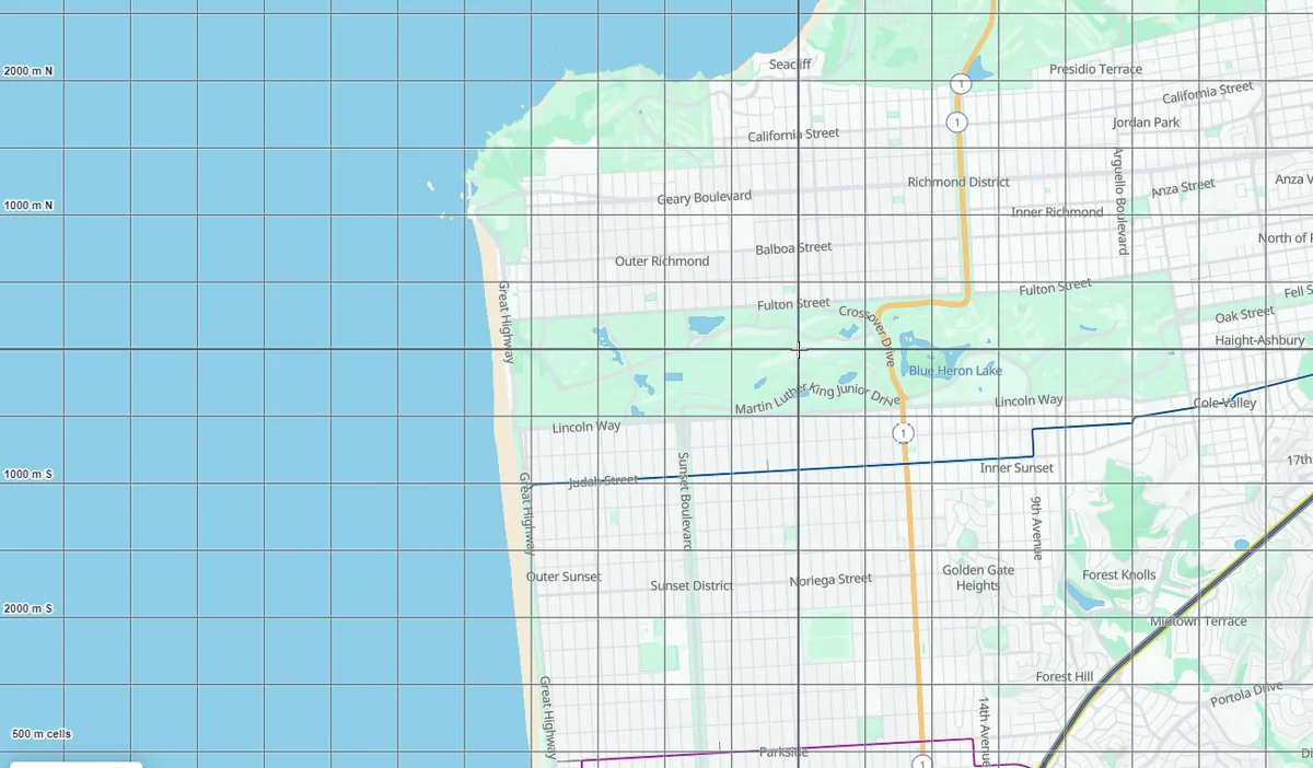
Pick a cell size and a unit (meters, kilometers, feet, yards, miles or nautical miles), and the grid covers the map in squares of exactly that size. It is useful for search areas, survey plots and field sampling. Heavier lines cross at the grid's origin, and the edge labels show distances from it, such as "1000 m E" or "2000 m N". Center on map puts the origin in the middle of your view.
H3 Hexagons: the grid analysts use
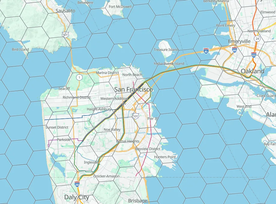
H3 is the hexagon system that Uber built and that many data and delivery teams now use to group locations. Leave the resolution on Auto and Scribble Maps picks a hexagon size that suits your zoom, or fix it anywhere from 0 (largest) to 15 (smallest). When hexagons are large on screen, each one shows its H3 cell ID, so you can match your map to your data.
GARS: one language for every agency
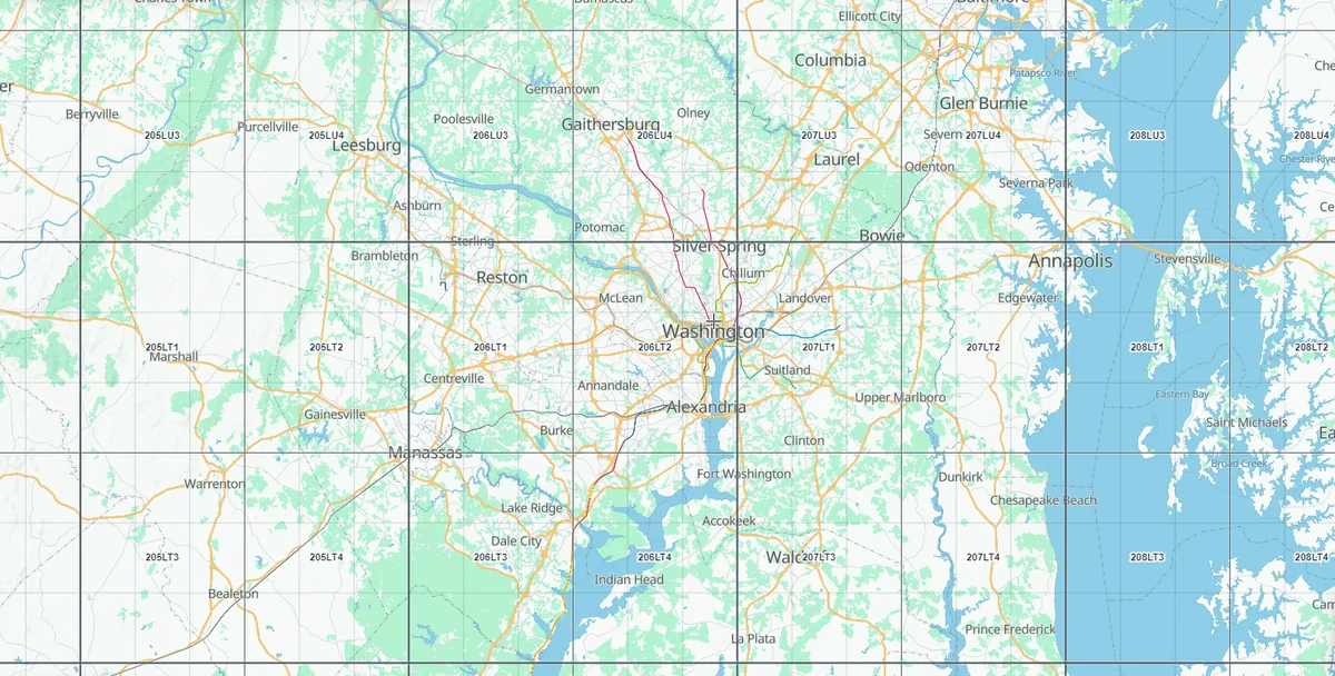
The Global Area Reference System gives every part of the world a short name. US defense and emergency management teams use it to coordinate across agencies. Scribble Maps shows the 30-minute cells (such as 006AG), and as you zoom in, the 15-minute quadrants (006AG3) and 5-minute keypads (006AG37).
Maidenhead: grid squares for ham radio
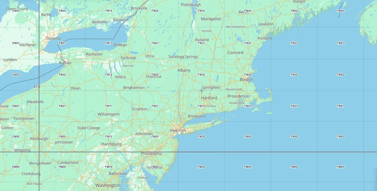
Amateur radio operators trade grid squares in every contact, contest and award. Turn on Maidenhead and you see fields (FN), squares (FN31), subsquares (FN31pr) and extended squares (FN31pr45) as you zoom in, drawn over a real map. Plan a rove, check which grid a park sits in, or share your station's grid with the club.
Range Rings: distance at a glance
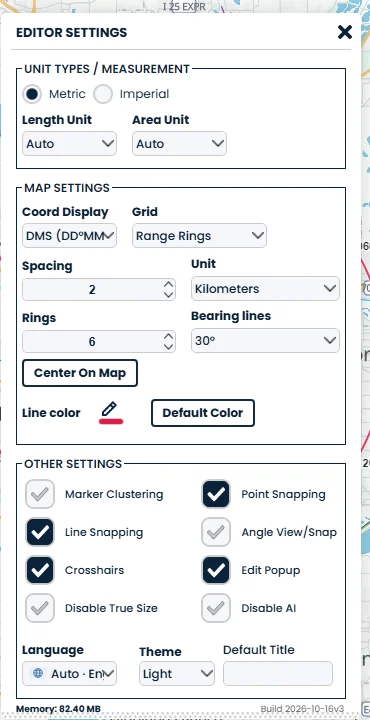
Range Rings draw circles at a set distance around a point, with bearing lines from the center. Use them for coverage areas, evacuation zones, delivery radius or a radio station's reach. Set the spacing and unit, choose from 1 to 50 rings, and add bearing lines every 10, 15, 30, 45 or 90 degrees. The rings show true distance on the ground, so a 5 km ring really is 5 km anywhere in the world.
Rebuilt LatLon and UTM grids
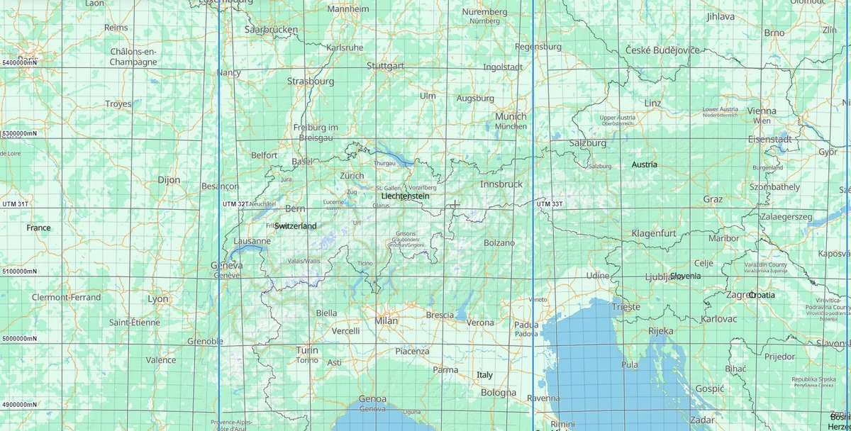
The everyday grids got a full rebuild too:
- Labels at the edges of the map, with lighter lines between the labelled ones so you can estimate a position.
- Spacing that fits the zoom. From 20 degrees down to 0.001 degree on the LatLon grid, and from 100 km down to 10 m on UTM.
- Degrees, minutes and seconds. If your coordinate display is set to DMS, the LatLon labels and lines follow it.
- UTM zone tags such as UTM 32T, including the special zones around Norway and Svalbard, and a full UTM reference in the coordinate readout.
- A faster British National Grid that keeps up as you pan and zoom.
Any color you like
Every grid now has a Line color setting, including MGRS and USNG. Pick a color that stands out on your base map, or click Default color to go back to the grid's own colors. Labels keep their colors so they stay easy to read.
Just ask Scribble
Scribble, the AI assistant in the editor, knows every grid. Try:
- "Show 2 km range rings around the map center"
- "Add a map reference grid with 10 columns"
- "Show H3 hexagons at resolution 8"
- "Make the grid lines red"
Try it
Open a map, click the gear icon at the bottom left of the map to open Settings, and choose a grid from the Grid list under Map Settings. Its options appear right below the list.
The LatLon, UTM, USNG, MGRS and BNG grids are free for everyone. Map Reference, Square Grid, H3, GARS, Maidenhead and Range Rings are part of Pro. Not on Pro yet? Log in and you can try them with trial credits, or see the plans. Opening a map that already has one of these grids is always free, so everyone you share your map with sees it.
For the details, read Add a map grid overlay and View the grid (LatLon or UTM) in the help center.